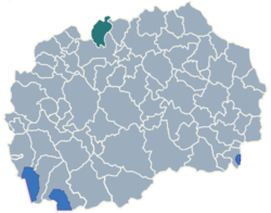
Municipality of Cucer-Sandevo
Municipality of Cucer-Sandevo
Општина Чучер-Сандево

-
Statistical region:Skopje
-
GPS Coordinates:42° 7' 29.87" N, 21° 23' 58.74" E
-
Area:215 km2 (133.59 sq mi)
-
Area phone code:02
-
Car plates:SK
-
Inhabited places:12
-
Population:8,493 - 2002 census
-
Population density:39.5 people/km2 (63.58 people/sq mi)
-
Address:Municipality of Cucer-Sandevo
1011 Kuceviste, Macedonia
Places in Municipality of Cucer-Sandevo
-
Kuceviste (village) - seat of Municipality of Cucer-Sandevo
-
Villages Cucer-Sandevo municipality (12)
- Banjane
- Blace
- Brazda
- Brest
- Brodec
- Cucer Sandevo
- Gluvo
- Gornjane
- Kuceviste
- Mirkovci
- Pobozje
- Tanusevci
About Municipality of Cucer-Sandevo
Cucer-Sandevo is a municipality in the north part of Republic of Macedonia. Kuchevishte is the name of the village where the municipal seat is found. Cucer-Sandevo municipality is part of Skopje statistical/administrative region of Macedonia.
The population of the Cucer-Sandevo municipality is 8,493 of whom 3,167 live in the municipality center Kuchevishte, while the rest lives in the villages of the municipality.
Municipality of Cucer-Sandevo map
Welcome to the Cucer-Sandevo municipality google satellite map!
Cucer-Sandevo municipality is situated in Skopje region of Macedonia, and its central area coordinates are 42° 7’ 29.87” North, 21° 23’ 58.74” East and its original name (with diacritics) is Cucer-Sandevo.
Cucer-Sandevo hotels map is available on the target page linked above.
Municipality of Cucer-Sandevo google satellite map
Photos nearby Municipality of Cucer-Sandevo area
See Municipality of Cucer-Sandevo photos and images from satellite below, explore the aerial photographs of Municipality of Cucer-Sandevo in Macedonia.
Links
Municipalities in Skopje region
- Municipality of Aerodrom
- Municipality of Aracinovo
- Municipality of Butel
- Municipality of Cair
- Municipality of Centar
- Municipality of Gazi Baba
- Municipality of Gjorce Petrov
- Municipality of Ilinden
- Municipality of Karpos
- Municipality of Kisela Voda
- Municipality of Petrovec
- Municipality of Saraj
- Municipality of Sopiste
- Municipality of Studenicani
- Municipality of Suto Orizari
- Municipality of Zelenikovo


