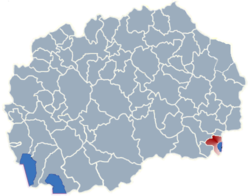
Dzumabos
Dzumabos (Dojran - Dojran area)
Dzumabos / Џумабос

-
English name:Dzumabos
-
Macedonian name:Џумабос
-
GPS Coordinates:Latitude: 41° 17' 44.76" N
Longitude: 22° 40' 52.67" E -
Area phone code:034
-
Postal code:1485
-
Car plates:VE
-
Time zone:
Summer (DST)CET (UTC+01:00)
CEST (UTC+02:00) -
Population:0 - 2002 census
About Dzumabos
Dzumabos is a village in the Dojran municipality of Macedonia. Dzumabos original name (with diacritics) is Dzumabos. Dzumabos distance is 13.05 km / 8.11 mi away from the center of the municipality.
Dzumabos accommodation: Dzumabos hotels - Dzumabos apartments
With Makedonija.name and Booking.com the best price is guaranteed!
Dzumabos hotels map is available on the target page linked above.
Dzumabos hotel deals include also long stay accommodation Dzumabos offers. Take advantage of our exclusive offers and long stay discounts for selected Dzumabos hotels' suites.
Dzumabos map
Welcome to the Dzumabos google satellite map! Dzumabos Village is situated in Municipality of Dojran, Dojran, Macedonia, its geographical coordinates are 41° 17' 44.76" North, 22° 40' 52.67" East.
Dzumabos map - Dzumabos google satellite
[Map Height : Small - Medium - Large]
Photos nearby Dzumabos - Dzumabos image gallery
See Dzumabos photos and images from satellite below, explore the aerial photographs of Dzumabos in Macedonia.


makedonija.name doesn't own or control these photos.
Photos provided by Panoramio are under the copyright of their owners.
Places nearby Dzumabos
- Durutli 0.38 km
- Sevendekli 1.07 km
- Kurtazamli 1.1 km
- Bashibos 1.64 km
- Organdzali 1.83 km
- Kochuli 2.18 km
- Buluntuli 2.52 km
- Bajrambos 2.52 km
- Prsten 2.84 km
- Chaushli 3.28 km
- Chalakli 3.49 km
- Sobri 3.89 km
- Tatarli 3.92 km
- Gjopcheli 4.61 km
- Dorlombos 4.87 km
- Memeshli 5.29 km
- Ormanli 6.26 km
- Dedeli 6.52 km
- Nikolik 6.52 km
- Crnichani 6.99 km
- Furka 8.31 km
- Nov Dojran 8.8 km
- Rabrovo 8.93 km
- Kosturino 9.02 km
- Chestevo 9.03 km
- Kazandol 9.34 km
- Valandovo 10.32 km
- Svidovica 10.67 km
- Zleshevo 11.09 km
- Bansko 11.19 km
- Tri Vodi 11.92 km
- Kuklish 12.43 km
- Pirava 12.86 km
- Star Dojran 13.06 km
- Gabrovo 13.07 km
- Vejseli 13.12 km
- Raborci 13.12 km
- Brajkovci 13.16 km
- Bogdanci 13.51 km
- Murtino 13.74 km


